Where have I been
Wow, it's been a long time since I've posted. Sorry, things have been crazy for the last few months. I finally made the leap into planning, now studing for an MCP at Penn. More news to follow.
Wow, it's been a long time since I've posted. Sorry, things have been crazy for the last few months. I finally made the leap into planning, now studing for an MCP at Penn. More news to follow.
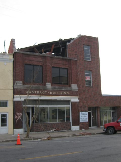
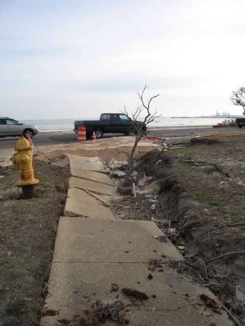
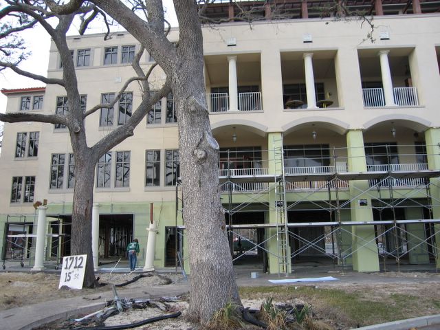
In Gulfport Mississippi three highways essentially define the city – Interstate 10 forms the northern boundary, Highway 49 running north-south bisects the city, and Highway 90 runs east-west along the Gulf Coast forming the city’s southern border. Of the Mississippi coast communities ravaged by Hurricane Katrina, Gulfport seems to have suffered the least amount of damage. That’s not to say it escaped unscathed – everything along the coast to roughly three blocks inland was ruined or completely washed away down to the foundation. All trees along the coast, literally thousands of trees including hundreds of heritage elms, were killed by the saltwater. Damage inland from that point is more sporadic – a destroyed restaurant amid undamaged strip malls and houses with damaged roofs miles inland. The vast majority of Gulfport residents are fortunate in that their homes are intact and habitable. Typical of Southern cities, the bulk of Gulfport’s retail stores, restaurants and other services are located not downtown, but along a strip, in this case Highway 49. Except for a closed Barnes & Noble bookstore, all big box stores and almost all small businesses along this corridor suffered little if any damage and are open for business. From a macro perspective Gulfport is generally intact.





Note: As of January 2006, this study is a work in progress and data compilation has not yet been completed. The observations made in this essay are based on the author’s observations and are not the result of concluded data analysis. A list of the 200 observed cities and initial data compilation my be obtained by contacting the author: a_reback@usa.net


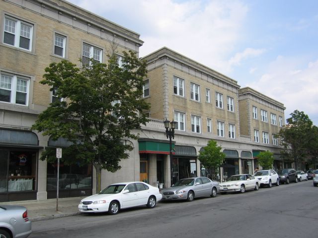


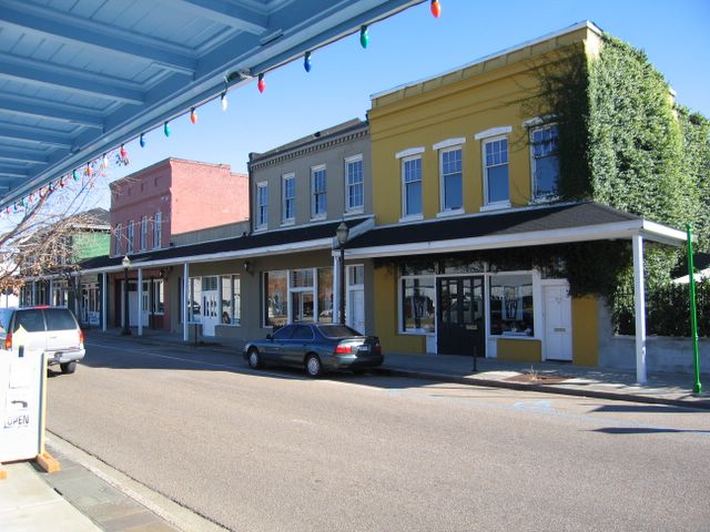
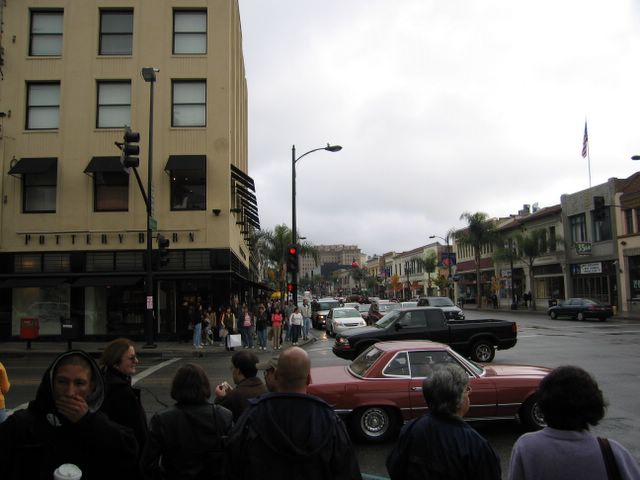
You hear residents talk about it all the time – they want a more vibrant downtown, they want homes that fit with the character of their town, or they want to attract a mix of people and businesses to town. But when the tools necessary to achieve these outcomes are mentioned, opposition is immediately encountered. Higher-density projects, defined floor-to-are a rations, and diversity of housing types all provoke a response and frequently the response can stagnate any opportunity to grow a city. Clearly a gap exists between what residents believe they want and what planners are communicating.


With the profound devastation that has hit New Orleans, the question now is what's next for the residents and the city itself. Should the levees just be rebuilt, new pumps be installed, and the city be rebuilt just as it was? Or would people be better served with a New New Orleans? For this discussion, let's just call this improved city New NOLA.


Some 7 million residents in nine counties, Santa Clara, San Mateo, San Francisco, Marin, Contra Costa, Alameda, Solano, and Sonoma counties surround either the San Francisco Bay or San Pablo Bay. Additional details on the Bay Area on Wikipedia.
As you look on this site at the pictures of revitalized downtowns and new mixed-use products, or walk through modern Bay Area communities, you begin to notice a certain sameness to these cities -- curbside parking sure, wide sidewalks, and other attributes of pedestrian-friendly cities. But at the same time, the commonality seems to be extending to the design of the buildings and streetscapes - brick sidewalks, tree planters at crosswalks, stucco buildings with street-level retail and offices or residential on subsequent floors, never exceeding 3 or 4 stories. One can't help but wonder if in a few years we'll all be tired by the sameness of design between each of the towns. Given that we're only a few years into the "new urbanism movement," it's scary to think the cities embrassing new urbanism are already feeling common. Perhaps what we need is more diversity not only in product design, but equally in the land use and regional considerations.
Last night I saw a presentation by Fred Kent, president of Project for Public Spaces, during which he talked about good and bad designs for parks and open spaces. Interestingly, the characteristics of what we as residents consider a great park is often at odds with those parks that win design awards by landscape architects who judge these things. Importantly, what makes a park or more generally open space great is that people use it. What people will use a space for cannot be known ahead of time.
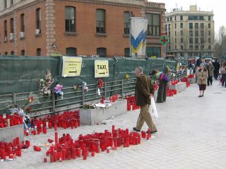 While in Madrid in March 2004, a few weeks following the horrible terrorist bombing of the Madrid train station, a wide sidewalk became a spontaneous memorial to those who lost their lives in the attack. No planner could have planned for this area to be used as a memorial, but the existance of space allows people to make use of it as their needs change. This memorial affected not only the people who lit candles, but hundreds of thousands of people who passed by every day. It is the unanticipated uses of open space that makes it so necessary, and equally why design is less important in the creation of space, than ensuring that a space can be used for multiple purposes.


A 2003 extension of the Bay Area's rapid transit system, BART, south from Daly City approximately 7 miles to San Francisco Airport and terminating in Millbrae affords Peninsula cities the chance to develop the "right" solutions for these areas. With transit, high density proximate housing provides residents with the opportunity to reduce car trips and develop housing for people who don't have cars, don't want to drive, or anyone wishing to take advantage of proximate public transportation. Colma is building just this kind of solution.

It's amazing to see what a town can do. The city of San Mateo (on the Peninsula, 20 miles south of San Francisco) with a population of some 100,000 had a relatively quiet (read - low pedistrian traffic, little vibrant retail, few entertainment options) downtown. Around 2002 a multi-theater movie theater opened downtown and with increased traffic downtown, rents increased, slow retailers moved out, failing restaurants closed, and a lot of businesses that had been around for decades were gone. While this might seem like a sad story about gentrification, this is all good news. National retailers didn't move in and take over the city, rather new restaurants have opened, new retail stores have gone in, and the city is vibrant as it hadn't been for decades previously.
The interesting thing about city planning commissions is how much time and effort they need to spend on individual residential inquiries -- understanding the impact on a neighbor's view, determining if the specified trees are compliant with the city's expectations, providing guidance on fence setbacks. Over the course of 2 hours, 90 minutes or more could be spent on these items. How then does a planning commission get to focus on the larger scale issues that impact the quality of life for hundreds if not thousands of residents, business owners, and visitors? Some municipalities are using "visual" planning codes which do away with most of the text of existing codes and literally have pictures and illustrations to communicate what is acceptable and what is unacceptable to the municipality. Compliance by an architect/builder to the guidelines generally means auto-approval, speeding the development process. A proposal not adhering to the specification must go through a "significant" review justifying why the plan needs to be out of specification. Given that the visual plan represents the desires of the municipality and the community as a whole, approval to violate the code is an unlikely event.
Many people in the urban planning field are idealists continually striving for optimal designs. Sometimes this relentless pursuit of the ideal hinders wider adoption by cities, builders, and citizens of good planning principles. The result? We as Americans have some really great cities and living places, but 90% of what is still being built is ugly sprawl. So - how do we fix that? The solution is not to exclusively focus on refining good design priciples. Rather, we need to significantly increase the number of builders, contractors, city planners, planning commissions, citizens who understand, want, and build to good design practices and have aligned objectives.
Merced, in California's Central Valley, is currently undergoing a revitalization of sorts. Here you can see the streetscape has been designed to be more pedestrian-friendly, and indeed, some new retailers are moving in -- you can see in the picture Starbucks as an early downtown tenant.
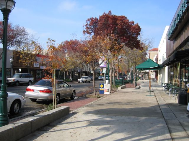 Housing is situated nearby, certainly within a few minutes drive, but there is no housing immediately downtown just yet. A single mixed-use building with ground floor retail with lofts above, an interesting concept for the Central Valley, is nearing completion. For the time being though, what's critically lacking are people.
 Martin Dreiling of CSS Architects in Burlingame, CA and Dan Ionescu of DIAP Architects in San Mateo, CA are proponents of public gathering spaces in cities and towns to provide citizens space for entertainment, public meetings, and enable a variety of social interactions. On a recent trip to Puerto Vallerta Mexico I took some pictures of just such a space and just such a gathering. On a Sunday night local families were sitting, talking, and dancing to a band playing. Interestingly at the moment we were, we saw the other intended use of open space - a group of protesters came fighting of all causes, the proposed elimination of these squares. More to come...